MTIJ2019 - Mass Trans Innovation Japan
Swiss Companies ShowroomSWISS Pavilion at Mass-Trans Innovation Japan
On the 27th to the 29th of November, the 6th Mass-Trans Innovation Japan exhibition will take place at Makuhari Messe.
Mass-Trans Innovation Japan is Japan’s largest and only comprehensive trade fair on the railway industry, where all railway technologies such as rolling stocks and structures, operation management, passenger facilities, tracks, and civil engineering are gathered together.
With a selection of companies from around the world, 13 companies will be exhibiting at the SWISS Pavilion to introduce their outstanding innovation and products. In pursuit of safety, security, comfort, environment and energy saving, we will introduce Swiss railway technology with a focus on the development and application in the field.
Please make sure not to miss this opportunity to experience Swiss railway technology that will help shape our future globally.
We look forward to seeing you at SWISS Pavilion, C-06 / Hall 6.
| Company Name EN | Leica Geosystems AG |
|---|---|
| Company Name JP | ライカジオシステムズ株式会社 |
| Swiss Company Address | Heinrich-Wild-Strasse Heerbrugg 9435 Switzerland Map It |
| Phone HQ | +41 71 727 3131 |
| Email HQ | Email hidden; Javascript is required. |
| Website HQ | leica-geosystems.com |
| Products | ‐Leica Pegasus:Two Ultimate |
| Address JP | 東京都港区三田1-4-28 ライカジオシステムズ株式会社,三田国際ビル18F 108-0073 Map It |
| Email JP | Email hidden; Javascript is required. |
| Phone JP | +81 3 6809 3901 |
| Company Description | Revolutionising the world of measurement and survey for nearly 200 years, Leica Geosystems, part of Hexagon, creates complete solutions for professionals across the planet. Known for premium products and innovative solution development, professionals in a diverse mix of industries, such as aerospace and defence, safety and security, construction, and manufacturing, trust Leica Geosystems for all their geospatial needs. Leica Geosystems is a leading global provider of information technologies that drive quality and productivity improvements across geospatial and industrial enterprise applications. At MTI Japan 2019, Leica Geosystems will exhibit its state-of-the-art technology and products including mobile mapping solution, total solution for rail maintenance and refurbishment, 3D laser scanner, etc., which are demanded in Railways industry.
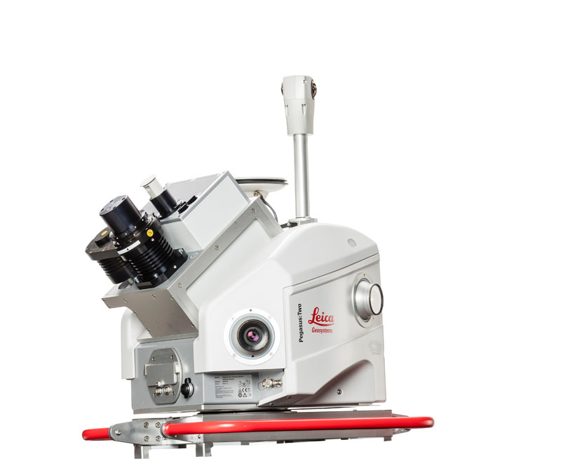
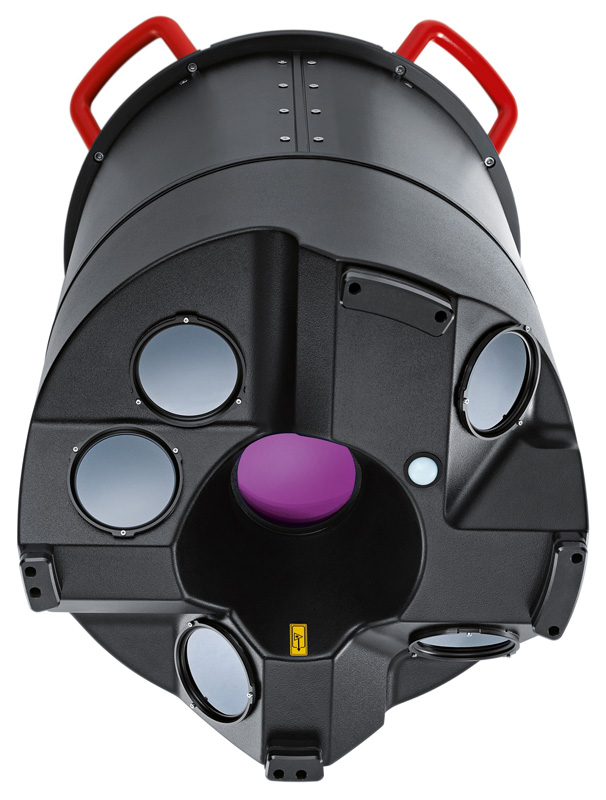
Leica Pegasus:Two Ultimate - On-board Mobile 3D Reality Capture System With fast and high accurate laser scanner, high resolution 360 degrees camera and side camera which gets detail conditions integrated, Leica Peasus:Two Ultimate makes it possible to capture reality with any vehicles including cars, trains, and boats. To enable faster processing at the office, a removable SSD allows to simply eject your data and walk into the office. Allowing capture in a variety of lighting conditions and vehicle speeds, a higher dynamic range is enabled by a large sensor to pixel ratio and a dual-light sensor. It also carries onboard JPEG compression for high resolution image measurement. You can also add thermal camera on as an option to calibrate the thermal data with point cloud data.
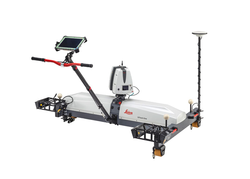
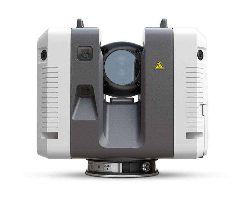
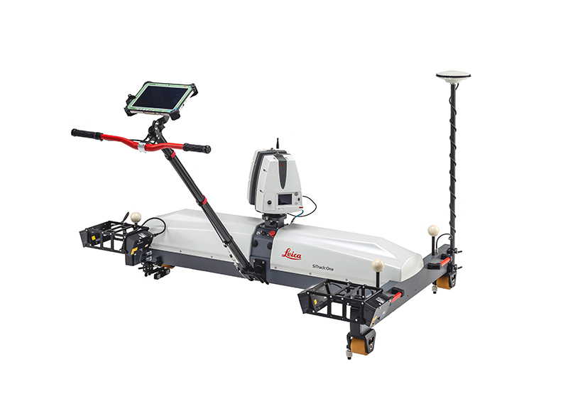
Leica SiTrack:One – High-Accuracy Rail Measurement System Complete coverage of the entire rail infrastructure surface without the need to receive GNSS signals for position information. Leica SiTrack:One is the highest accuracy system among our mobile mapping solution. The sophisticated system is equipped with two powerful Distance Measurement Instrument (DMI) with high-end IMU that provide accurate positioning in GNSS-denied areas, such as underground railway tunnels. Putting our highly accurate rail profiler on the wheels, you can find the little distortion of the rails such as galls and dents. A full day’s work of surveying can easily be accomplished with re-chargeable, hot-swappable batteries.
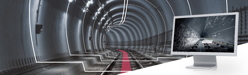
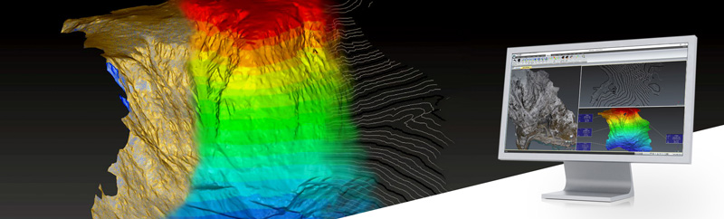
Leica SiRailScan - Intelligent Rail 3D Processing Software Complete extraction of the as-built railway network with engineering accuracy. By analysing the as-built infrastructure of the rail network, increased safety through train control and cost effective engineering is achieved. With best-in-class batch processing and network extraction, Leica SiRailScan is ideal for monitoring and maintenance of private or public rail networks.
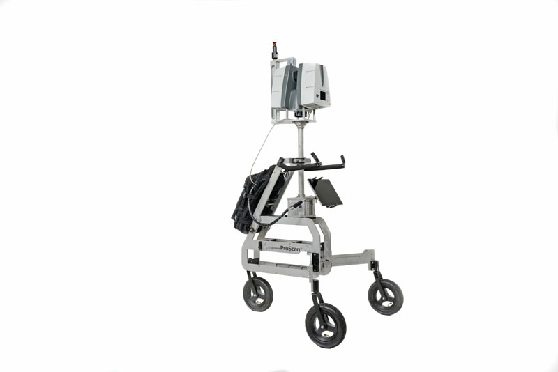
Leica ProScan – No Need to Register Scan Data: Trolley Type Mobile Reality Capture Platform for Civil Engineering You can scan indoors and outdoors without the need to register your scans. Release from the registering tasks made a case increased the work efficiency by 3 times. This system offers maximum flexibility and can be connected to a variety of Leica laser scanners and TPS systems. By utilising the ProScan platform, your traditional terrestrial laser scanner will turn into a kinematic 3D measurement system. Tracking the platform with TPS guarantees unconstraint moving, highest flexibility and the best accuracy possible thanks to the innovative tracking.
Leica RTC360 – Fast and Automated Stationary 3D Reality Capture Solution Enables users to create coloured 3D point clouds in under two minutes with a measuring rate of up to 2 million points per second and advanced HDR imaging system. Plus, automated targetless field registration (based on VIS technology) and the seamless, automated transfer of data from site to office reduce time spent in the field and further maximise productivity. Small and lightweight, the Leica RTC360 scanner’s portable design and collapsible tripod mean it’s compact enough to fit into most backpacks, ready to be taken anywhere. Low noise data allows for better images, resulting in crisp, high-quality scans. Combined with Cyclone FIELD 360 software for automated registration in the field, the Leica RTC360 scanner offers outstanding precision that can be checked on-site.
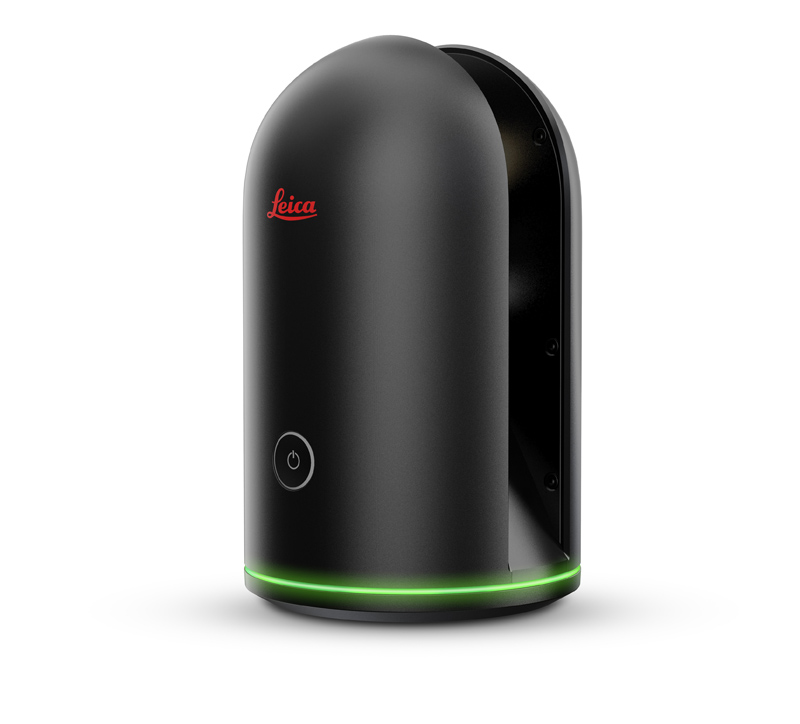
Leica BLK360 – Small and Lightweight Stationary 3D Laser Scanner Stationary laser scanner which captures the world around you with full-colour panoramic images overlaid on a high-accuracy point cloud. Simple to use with the single push of one button, the BLK360 is the smallest and lightest imaging laser scanner of its kind with its weigh of 1 kg and size of 165 mm tall x 100 mm diameter. Using Leica Cyclone FIELD 360 or the Autodesk ReCap Pro mobile-device app allows the user to check or register the captured data on site. With automated workflows in both software offerings, the BLK360 plus the software solution of your choice, dramatically streamlines the reality capture process thereby opening this technology to non-surveying individuals.
Leica CloudWorx - CAD plugins Allowing Efficient Use of Point Cloud Data Allow users to work efficiently with large point clouds directly inside their chosen CAD system. They can use the native CAD tools and commands and the entire set of specialised point cloud commands provided by CloudWorx. The Leica CloudWorx plug-ins are available for a wide array of applications
Leica JetStream –Software Allowing Seamless Integration of Point Cloud Data Provides seamless use of your point cloud data with instant loading of all your points, all the time. No load times, no lag, just full resolution point clouds streaming directly to your CAD systems. Work with all your preferred CAD system in its native format using familiar commands and workflows. JetStream's exclusive rending capabilities provide efficiency gains unmatched by any other built-in or add-on solution available to allow your team to be more productive and provide maximum ROI for you and your clients.
3DReshaper – Software for Processing Point Cloud Data Easy-to-use and versatile software solution dedicated to processing any type of point cloud for a wide array of applications. From engineering to heritage, to surveying to manufacturing, 3DReshaper contains a complete toolbox to meet your 3D modelling and inspection needs.
Leica CityMapper – Hybrid Airborne Sensor for Urban Mapping The world’s first hybrid airborne sensor specifically designed for urban mapping. One sensor provides oblique and multispectral nadir imagery as well as LiDAR data. Collect |
| Product Images |

Contact

Swiss Business Hub Japan – Export Promotion
Embassy of Switzerland in Japan
5-9-12 Minami Azabu, Minato-ku, Tokyo 106-8589
Japan
Dir.: +81 3 5449 8434
Fax: +81 3 3473 6090
